Enjoyable Bessingby and Beach Stroll
Moderate Difficulty Walk of 4.5 miles Distance
Discover the old estate village of Bessingby then wander back along the beach
Details for Bessingby and Beach Stroll
- Reference: E64
- Circular walk: Circular
- Difficulty: Moderate
- Walk type: Coast and Beach Walks
- Ordnance Survey Explorer Map: 295
- Car Parking Facility: South Cliff car park (pay & display, closed in winter
- Refreshments: Shops, pubs and cafes in Bridlington
- Public Conveniences: Bridlington various
Further information
Features of interest
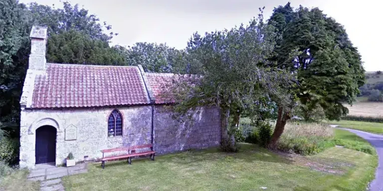
St Magnus Church, Bessingby was rebuilt in 1766 when, according to Bulmer’s History and Directory of East Yorkshire (1892) “architectural taste in this country had sunk to its lowest ebb, and the churches that were erected were but unworthy successors of the grand old edifices which they displaced”. The church contains several monuments to the Hudson family, lords of the manor at Bessingby Hall during the 19th century.
Accessibility
This route has a footbridge over the railway.Take care to check tide times before starting a walk along the beach (there is a path along the ‘cliff top’).Walking on sand can be difficult for people with mobility problems.
Additional information
This walk may be started from the roadside parking on Belvedere Road, as the South Shore car park is normally closed during the winter.
Download “Bessingby and Beach Stroll” map

Locations
- Start point: Belvedere (South Cliff) Car Park, Bridlington
- End point: Belvedere (South Cliff) Car Park, Bridlington
- Towns and villages: Bridlington, Bessingby and Wilsthorpe
- Parish: Bridlington
- Ward: Bridlington South
- Start Easting: 517291.27
- Start Northing: 464918.32
- End Easting: 517291.27
- End Northing: 464918.32
Distances
- Distance (miles): 4.5
- Distance (kilometres): 7
- Distance range: 0-5 miles