Enjoyable South Landing Trail
Easy Difficulty Walk of 1 mile Distance
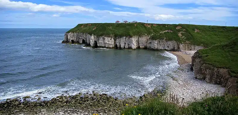
Follow this trail to the east of a deep natural gully and see migrating birds sheltering from strong sea winds and feeding.
Details for South Landing Trail
- Reference: E18
- Circular walk: Circular
- Difficulty: Easy
- Walk type: Coast and Beach Walks
- Ordnance Survey Explorer Map: 301
- Car Parking Facility: South Landing
- Refreshments: None
- Public Conveniences: Flamborough, North Landing
Further information
Features of interest
- Flamborough had a significant port from the early 14th to the late 16th century. A wooden pier was mentioned in 1400 when Robert Constable left £40 for its maintenance. However, it is not mentioned after 1569. Its most famous visitor was in August 1561 when two ships anchored close to the pier. They flew two flags; one was blue with the Arms of France and the other silver-white. On board was Mary Stuart sailing from France to claim the crown of Scotland.
- In later years many coal-carrying ships unloaded at South Landing to avoid paying the port tax at Bridlington. Flamborough fishermen had boats at North and South Landing, and depending on the tides and winds would sail from the more sheltered one. Both Landings had a lifeboat, and the first one to South Landing came in 1871. The various boats saved over 108 lives before it closed in 1938. Seaplanes were also launched from here during the First World War and the concrete base can still be seen.
- In February 1992, a 70-feet Fin Whale was washed up on the beach near to Sewerby. All large whales are uncommon but it’s quite common to see porpoises (a type of small whale) and seals around the headland. It is interesting to note that under Anglo-Saxon law, any place where a whale was washed ashore could be named a port…the port of Sewerby, anyone?
Accessibility
The South Landing trail:– contains some gentle slopes.- does not contain barriers.
Additional information
– The bird feeding area near the picnic/parking site is designed to cater for the area’s resident winter birds and is regularly stocked with food.
Download “South Landing Trail” map
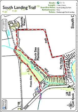
Locations
- Start point: South Landing car park
- End point: South Landing car park
- Towns and villages: Flamborough, Marton and Sewerby
- Parish: Flamborough
- Ward: Bridlington North
- Start Easting: 523,039.00
- Start Northing: 469,498.00
- End Easting: 523,039.00
- End Northing: 469,498.00
Distances
- Distance (miles): 1
- Distance (kilometres): 1.6
- Lengthened distance: 1 miles
- Shortened distance: 1 miles
- Distance range: 0-5 miles