A Trip to Spurn Point
Embark on a day trip to Spurn Point from Bridlington
Been to all the places to visit in Bridlington? Looking for a trip further afield?
Spurn Point or Spurn Head is a very unique place in the British Islands.
Three and a half miles long and only fifty metres wide in places. Extending out in to the Humber Estuary from the Yorkshire coast it has always had a big effect to the navigation of all vessels over the years.

Spurn is made up of a series of sand and shingle banks held together with mainly Marram grass and Seabuckthorn. There are a series of sea defence works built by the Victorians and maintained by the Ministry of Defence, till they sold Spurn to the Yorkshire Wildlife Trust in the 1950s.
One of the most striking features of Spurn is the black and white lighthouse near to the end of Spurn. Now just an empty shell not used since it was closed down at dawn on the 31st of October 1986.
A bird observatory was formed at Spurn Point in 1946 and it is still in existence today.
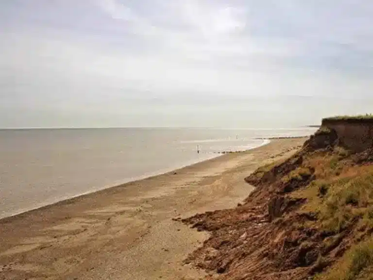
This unique coastal national nature reserve features a long sandy spit stretching three and a half miles into the Humber Estuary from the Holderness Coast. Habitats found here include chalk grassland, mature sand dunes, sandy beaches on the seaward side and mud flats on the estuary side. A Mecca for birdwatchers, many rarities can be spotted here, along with thousands of migrants and winter visitors. Spurn National Nature Reserve forms part of the Humber Estuary Special Area of Conservation. This unique coastal reserve is also part of the Spurn Heritage Coast. It is possible to wander freely over much of the reserve. Several interpretation boards are located around the reserve, with more detailed information displays at the Blue Bell cafe and at the Warren. There are toilets in the public car park at the Blue Bell. A seasonal cafe operates at the point near to the RNLI houses. Parking is available in the public car park at the Blue Bell or by travelling down the peninsula to the Point for which there is a charge of £3 per car.

The lighthouse trail begins at Spurn where there are two lighthouses situated close to each other at the Southern end of the Point. There have been lighthouses on Spurn since 1427 because of the dangerous currents and sandbanks that lie beneath the Humber’s surface. There is little record of what Spurn’s earlier lighthouses looked like, but we do know they have been built in pairs since 1674 and at least eight have been swept away in storms. They were built in twos (called high and low lights) to help sailors navigate in the Humber estuary. In 1852 the last, and still standing, low light was built. However when the present lighthouse was built the low light was no longer needed as three additional lamps were placed in the body of the lighthouse instead. It has since been used as an explosive store and a water tower. Now it stands deserted.
Thomas Matthews designed the present lighthouse in 1895 when the previous one was discovered to be cracking. It stands on an artificial rock foundation that goes down 22 feet (7m) and took nearly two years to build. Later the oil lam was converted to electricity (1941) and gas (1957) on which it ran until 1985 when it was last used.
Spurn Lighthouse
- First lighthouse built: 1427
- Current lighthouse built: 1893-95
- Height: 128ft (39m)
- Steps: 145
- Made of: 300, 000 Staffordshire bricks
- Designed by: Thomas Matthews
- Built by: Strattens of Edinburgh
- Last day of use: 31st October 1985
- Location: End of Spurn Point
- Access: No public access inside. Sited on National Nature Reserve. Charge for vehicle entry to reserve. No dogs permitted on reserve.